Driving the South Coast of Iceland
How to drive Iceland's South Coast from Seljalandsfoss to Skaftafell, with honest timings, parking logistics, and the stops worth pulling over for.
- Flag
-
- ISO code
- IS
- Currency
- ISK
- Timezone
- Atlantic/Reykjavik
The South Coast Drive is a Deceptively Long Day
You look at a map of the south coast from Reykjavík to Jökulsárlón and think you can do it in a long day. You cannot. The 458 km from Selfoss to Höfn, with no stops, clock in at five and a half to six hours. But you will not do it with no stops, and wind will add time unpredictably. The real question is how to pace the drive so you see the two famous waterfalls, Reynisfjara and the glacier lagoon without rushing the quieter stops that make the trip memorable. The answer is two nights on the road. Leave Reykjavík by 08:00, accept that the stretch from the first falls to Vík will consume a full day, and sleep in or near Skaftafell on night two, positioning you at Jökulsárlón by 09:00 on day three.
From Reykjavík to Seljalandsfoss: the First Waterfall and Its Hidden Neighbour
Fuel up before you leave Reykjavík. The longest gap between petrol stations on this corridor is 70 km, from Kirkjubæjarklaustur to Skaftafell, but starting with a full tank removes the anxiety of finding an unmanned pump with an uncooperative card reader. Drive Route 1 east for roughly two hours to reach the first cascade.
The main fall drops 60 m, and you can walk behind it from May through September. The parking lot uses the Parka app for payment; download it before you arrive because mobile signal at the lot can be patchy. Pay before you walk, and keep your phone dry inside a jacket pocket. The spray will soak you even on a still day.
Gljúfrabúi Is 600 Metres Away And Completely Different
From the car park, walk 600 m east along the base of the cliff. You will see a slot canyon with a stream pouring out of it. That is Gljúfrabúi. You wade into the canyon, and the waterfall is inside, in the dark. It is quieter, wetter, and almost nobody goes there because they stop at the first waterfall and turn around. Do not be that person. Budget 20 extra minutes for this detour.

Seljalandsfoss to Skógafoss: the 29 Kilometre Gap You Fill with Kvernufoss
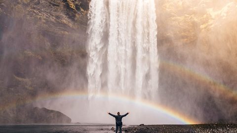
Drive 29 km east on Route 1 to the second major fall. This 60 m curtain of water is 25 m wide. Climb the 527 steps to the viewing platform for a view across the coastal plain, but only if the wind is below 20 m/s. Above that threshold, the platform is unpleasant and the steps are slippery.
The site draws roughly 700,000 people a year. You will share the parking lot with tour buses. The way to escape them is Kvernufoss, a 30 minute walk from the main car park. Walk east past the museum, cross a small bridge, and follow the valley. The path ends at a 30 m fall you can also walk behind. It receives a fraction of the crowd. Do this before the big fall, or immediately after, while the buses are still unloading.
Why This Short Drive Eats Hours
The six minutes it takes to drive between the two falls is the most deceptive metric on the south coast. With the hidden canyon, the Parka payment, the climb, the Kvernufoss walk, and the wind that will pin your car door shut when you try to open it, you will spend four to five hours here. Do not plan to push through in two.
Skógafoss to Vík: the Dyrhólaey Detour and Reynisfjara’s Real Danger
From the falls, drive 34 km east to the Vík area. You will pass the turn for Dyrhólaey, a volcanic arch on a headland. Take it. The detour adds 12 km of paved road and gives you a high angle view of the black sand coast and the Reynisdrangar sea stacks. In summer, puffins nest on the cliff. The road is narrow and the parking lot fills by late morning; arrive before 10:30.
Reynisfjara Demands a Different Kind of Attention
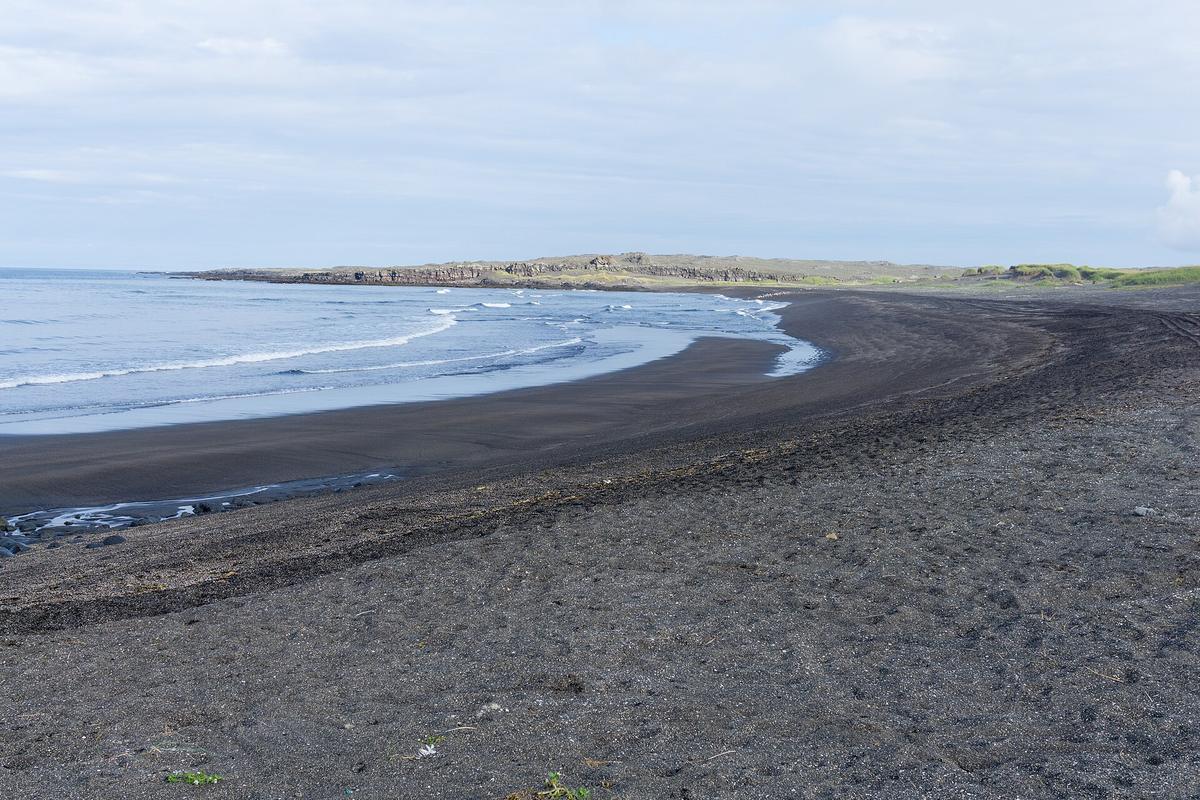
Reynisfjara is a black sand beach where five people died between 2013 and 2022. The danger is sneaker waves that surge past the waterline into the dry sand above the high tide mark with no warning. A warning light system was installed in 2022, but do not rely on it. Watch the ocean constantly, never turn your back to the water, and stay far above the wet sand line. A wave that looks small at sea can expand to fill the entire beach in seconds. Photograph the basalt columns and the cave, then leave. The adjacent beach at Vík village is safer for lingering.
Vík itself has 750 residents and one main street. Its petrol station sells lamb soup, which is the correct lunch choice. The town swimming pool is a good alternative activity when wind closes the coastal sites. Check road.is before continuing east.
Vík to Skaftafell: the Long Stretch That Makes You Want an Overnight
From Vík to Skaftafell is 140 km, roughly two hours of driving without stops. You will pass the village of Kirkjubæjarklaustur, which has a petrol station and little else. The landscape shifts from black sand plains to moss covered lava fields to the edge of Vatnajökull, Europe’s largest ice cap by volume at 3,100 cubic km and area of 7,700 square km. The ice averages 400 m thick and reaches 950 m at its deepest point.
This is where the driving day ends. Do not push past Skaftafell to Höfn. The park is the logical overnight pivot because it sits 56 km west of Jökulsárlón, which puts you at the glacier lagoon before the bus crowds. Farm stay guesthouses with breakfast included offer the best value on this corridor. They book out weeks ahead in summer; reserve at least three months in advance. The campground is another option if you have camping gear, but June through August it fills by late afternoon.
What to Do in Skaftafell When You Arrive
Walk to Svartifoss, a 20 m waterfall framed by columnar basalt. The trail takes 45 minutes each way from the visitor centre. Alternatively, book a glacier walk on Vatnajökull for the following morning. These operate in wind up to 20 m/s, which is higher than the closure threshold for the Ring Road itself, so they remain a viable option when coastal sites are shut.

Skaftafell to Jökulsárlón: the Morning You Have Been Waiting for
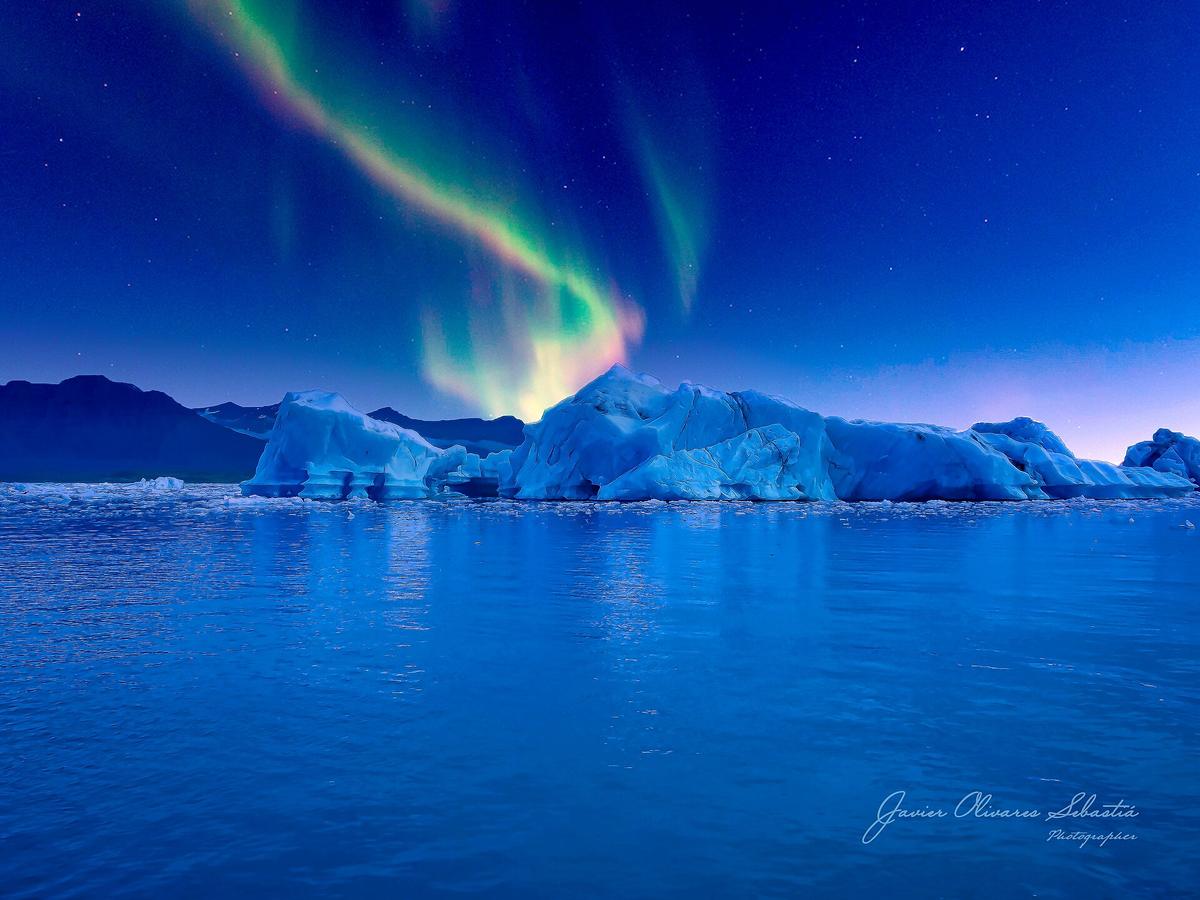
Leave the park by 08:00. Drive 56 km east. Within an hour you reach Jökulsárlón, an iceberg lagoon that opened to the ocean between 1934 and 1935. It reaches a maximum depth of 248 m and spans about 18 square km, though the surface area fluctuates with glacial melt. The icebergs calve from Breiðamerkurjökull, an outlet of Vatnajökull, and float toward the sea. Across the Ring Road bridge, 300 m on foot, lies Diamond Beach, where ice chunks wash up on black sand. They melt, they crack, they change every hour. Spend 30 minutes at the lagoon and 30 at the beach.
Zodiac tours at the lagoon book days ahead in summer. If you want to ride among the icebergs, reserve a slot at least 48 hours before. Without a booking, arrive by 08:30 and queue for the amphibious boat, which runs without reservations but has longer waits by 10:00. By 11:00 the car park is full and tour buses block the exit lane. Do not let this be your whole morning; the lagoon rewards an early, patient visit, not a rushed one.
The Honest Caveat
If you drive the south coast with two nights, you still will not see everything. You will skip the F roads inland. You will not hike to the highland huts. You will glance at Vestrahorn from the road and decide to keep driving. That is the correct trade off for a trip of seven days minimum. The south coast is the most visited route in Iceland outside Reykjavík for a reason. It delivers the raw, lunar character that first time visitors come for, but only if you accept that the map lies and the wind dictates your pace.
Places in South Iceland
More destinations in Iceland
What to See in South Iceland
-
 Jokulsarlon Glacier Lagoon
Why Jökulsárlón glacier lagoon demands an overnight stay, not a Reykjavík day trip, plus zodiac boat booking and Diamond Beach photography timing.
Jokulsarlon Glacier Lagoon
Why Jökulsárlón glacier lagoon demands an overnight stay, not a Reykjavík day trip, plus zodiac boat booking and Diamond Beach photography timing.
-
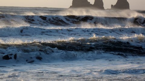 Reynisfjara Black Sand Beach
Reynisfjara is Iceland's most dangerous beach. Learn the sneaker wave warning system, where the death zone lies, and how to visit the basalt columns safely.
Reynisfjara Black Sand Beach
Reynisfjara is Iceland's most dangerous beach. Learn the sneaker wave warning system, where the death zone lies, and how to visit the basalt columns safely.
-
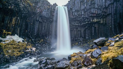 Skaftafell
 is the hiking gateway to Vatnajökull National Park. Compare trail lengths, the Svartifoss basalt column route, and glacier viewpoints before you arrive.
Skaftafell
Skaftafell is the hiking gateway to Vatnajökull National Park. Compare trail lengths, the Svartifoss basalt column route, and glacier viewpoints before you arrive.
-
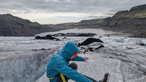 Solheimajokull Glacier
Sólheimajökull is Iceland's most popular beginner glacier hike. Learn what crampon-fitting feels like, how tough the walk is, and why unguided access is fatal.
Solheimajokull Glacier
Sólheimajökull is Iceland's most popular beginner glacier hike. Learn what crampon-fitting feels like, how tough the walk is, and why unguided access is fatal.
-
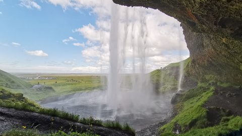 Seljalandsfoss
 lets you walk behind the cascade, but the real reward is Gljúfrabúi hidden in a canyon cleft next door. Learn the wading route and parking system.
Seljalandsfoss
Seljalandsfoss lets you walk behind the cascade, but the real reward is Gljúfrabúi hidden in a canyon cleft next door. Learn the wading route and parking system.
-
 Skogafoss
Skógafoss is more than the 60-metre curtain and 527 steps. The Skógá river trail above the falls leads to a chain of waterfalls most visitors never see.
Skogafoss
Skógafoss is more than the 60-metre curtain and 527 steps. The Skógá river trail above the falls leads to a chain of waterfalls most visitors never see.
-
 Thingvellir National Park
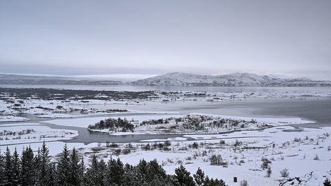
Þingvellir is three sites in one park: the tectonic rift walk, the ancient parliament site, and the Silfra fissure. Learn the parking zones and how to navigate them.
Thingvellir National Park
Þingvellir is three sites in one park: the tectonic rift walk, the ancient parliament site, and the Silfra fissure. Learn the parking zones and how to navigate them.
-
 Geysir and Gullfoss
 deserve more than a rushed photo stop. Learn how long Strokkur takes to erupt, where Gullfoss spray soaks you, and how to pace the Golden Circle.
Geysir and Gullfoss
Geysir and Gullfoss deserve more than a rushed photo stop. Learn how long Strokkur takes to erupt, where Gullfoss spray soaks you, and how to pace the Golden Circle.
Common Questions
Can I drive from Reykjavík to Jökulsárlón and back in one day?
Technically yes, but you will spend over ten hours driving and skip the hidden canyon, Kvernufoss, Dyrhólaey, and Svartifoss. The stretch from the first falls to Vík takes a full day with those detours. One day means you see only the main car parks.
How far ahead should I book a farm stay near Skaftafell?
Book three months ahead for June through August. Guesthouses with breakfast included fill weeks early. The campground does not take reservations and fills by late afternoon in peak season, so arrive before 15:00.
What do I do if wind closes the road between Vík and Skaftafell?
Route 1 closes when sustained wind exceeds 25 m/s or gusts hit 35 m/s. If you are stuck at Vík, use the swimming pool or drive to Hvollsvöllur for the Lava Centre. If you are near Skaftafell, book a glacier walk, which operates up to 20 m/s.
Is it worth adding the Dyrhólaey detour?
Yes, if you arrive before 10:30. The dirt road is short and the view of Reynisdrangar from above is better than from the beach. Puffins nest on the cliff in summer. After 11:00 the parking lot is full and the loop road is one way, so you might wait 20 minutes.
Read next
-
Jokulsarlon Glacier Lagoon
Why Jökulsárlón glacier lagoon demands an overnight stay, not a Reykjavík day trip, plus zodiac boat booking and Diamond Beach photography timing.
-
Reynisfjara Black Sand Beach
Reynisfjara is Iceland's most dangerous beach. Learn the sneaker wave warning system, where the death zone lies, and how to visit the basalt columns safely.
-
Skaftafell
Skaftafell is the hiking gateway to Vatnajökull National Park. Compare trail lengths, the Svartifoss basalt column route, and glacier viewpoints before you arrive.
-
Solheimajokull Glacier
Sólheimajökull is Iceland's most popular beginner glacier hike. Learn what crampon-fitting feels like, how tough the walk is, and why unguided access is fatal.
-
 Vik
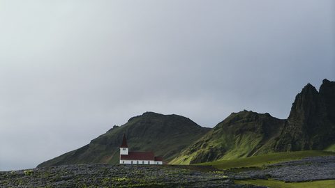
Understand the dangers of Reynisfjara’s sneaker waves and plan a safe, rewarding stop in Vík on Iceland’s south coast.
Vik
Understand the dangers of Reynisfjara’s sneaker waves and plan a safe, rewarding stop in Vík on Iceland’s south coast.
-
 Iceland Accommodation Types from Farm Stays to Hostels
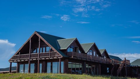
A hotel in rural Iceland rarely means what it means elsewhere. The real differences between guesthouses, farm stays, hostels and campsites before you book.
Iceland Accommodation Types from Farm Stays to Hostels
A hotel in rural Iceland rarely means what it means elsewhere. The real differences between guesthouses, farm stays, hostels and campsites before you book.
-
 Where to Stay in Iceland for a Ring Road Road Trip
On an Iceland lap, the road decides where you sleep. Which bases break the Ring Road into sensible chunks, and where inventory runs dangerously low in July.
Where to Stay in Iceland for a Ring Road Road Trip
On an Iceland lap, the road decides where you sleep. Which bases break the Ring Road into sensible chunks, and where inventory runs dangerously low in July.
-
 Keflavik Airport Flights Transfers and Iceland Domestic Routes
Keflavík to Reykjavík has no train. Flybus, taxi costs, rental car pickup, and when a domestic flight from Reykjavík City Airport saves a day of driving.
Keflavik Airport Flights Transfers and Iceland Domestic Routes
Keflavík to Reykjavík has no train. Flybus, taxi costs, rental car pickup, and when a domestic flight from Reykjavík City Airport saves a day of driving.
-
 Iceland Experiences Worth Booking and Those That Depend on Weather
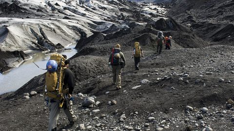
Some Iceland experiences vanish if you don't book weeks ahead. Silfra, ice caves, and Landmannalaugar huts sell out. Waterfalls and beaches just need you to show up.
Iceland Experiences Worth Booking and Those That Depend on Weather
Some Iceland experiences vanish if you don't book weeks ahead. Silfra, ice caves, and Landmannalaugar huts sell out. Waterfalls and beaches just need you to show up.